
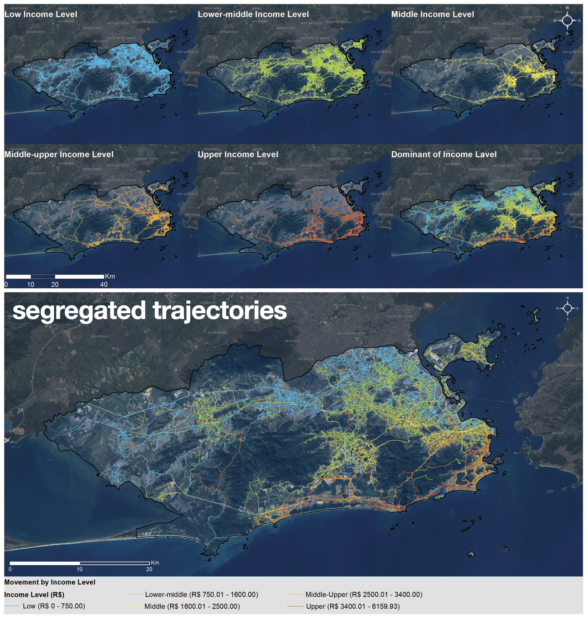
Segregated networks of movement in Rio, based on Twitter data: trajectories are mapped by income group — blue, low income; green, lower-middle; yellow, middle; orange, middle-upper; and red, high income. The larger map shows which income group is dominant across each segment of the street network (Netto et al., 2018).
We introduce a fundamental shift in how urban segregation is conceptualised and analysed. Rather than treating segregation only as a static pattern of residential separation, we understand it as a dynamic, real-time phenomenon produced through people’s movements, activities and encounters across the city. Since our early work in 1999, the central innovation has been the concept of socio-spatial networks: the interlacing of agents’ actions in space and time, shaped by urban morphology, mobility systems and the distribution of activities. In this view, cities are not passive containers of social groups, but active configurations that structure possibilities of co-presence, encounter and interaction. Urban segregation is therefore redefined as the degree of overlap, or disjunction, between these networks — not only as the spatial clustering of socially homogeneous populations.
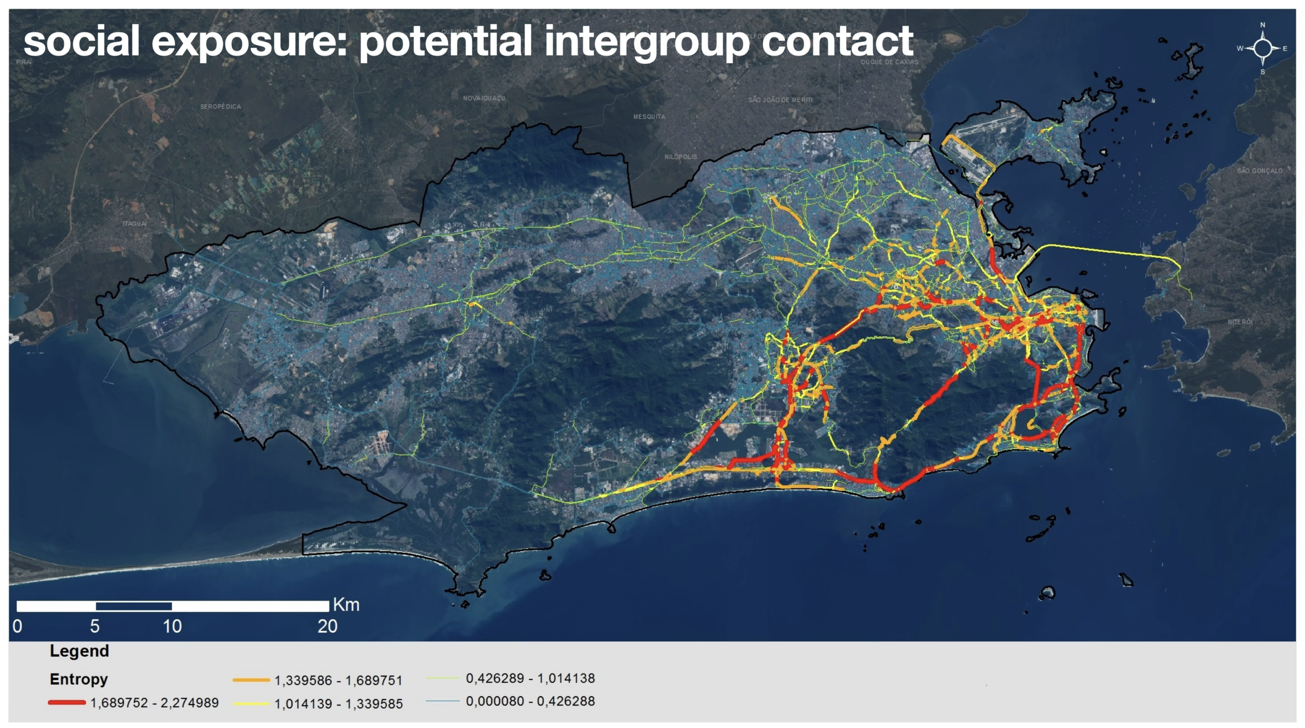
Social exposure: the potential for intergroup contact in the streets is represented through an entropy map, where red highlights the spaces with the highest levels of social diversity (Netto et al., 2018).
Building on this conceptual advance, we developed a modelling and measurement framework that links urban form, activity locations, movement patterns and social differentiation. The approach combines empirical data on people’s actual activities and trajectories with the reconstruction of paths through configurational properties such as centrality and shortest-path structures. This allows us to analyse flows between residences and activity places differentiated by social group, and to construct dynamic maps of social appropriation in which streets and activity locations are assessed according to levels of co-presence and potential interaction. A key methodological contribution is the translation of abstract social dynamics into quantifiable indicators of mobility segregation and social exposure — understood as the potential for intergroup contact generated by overlapping trajectories, rather than as a simple estimate of spatial proximity.
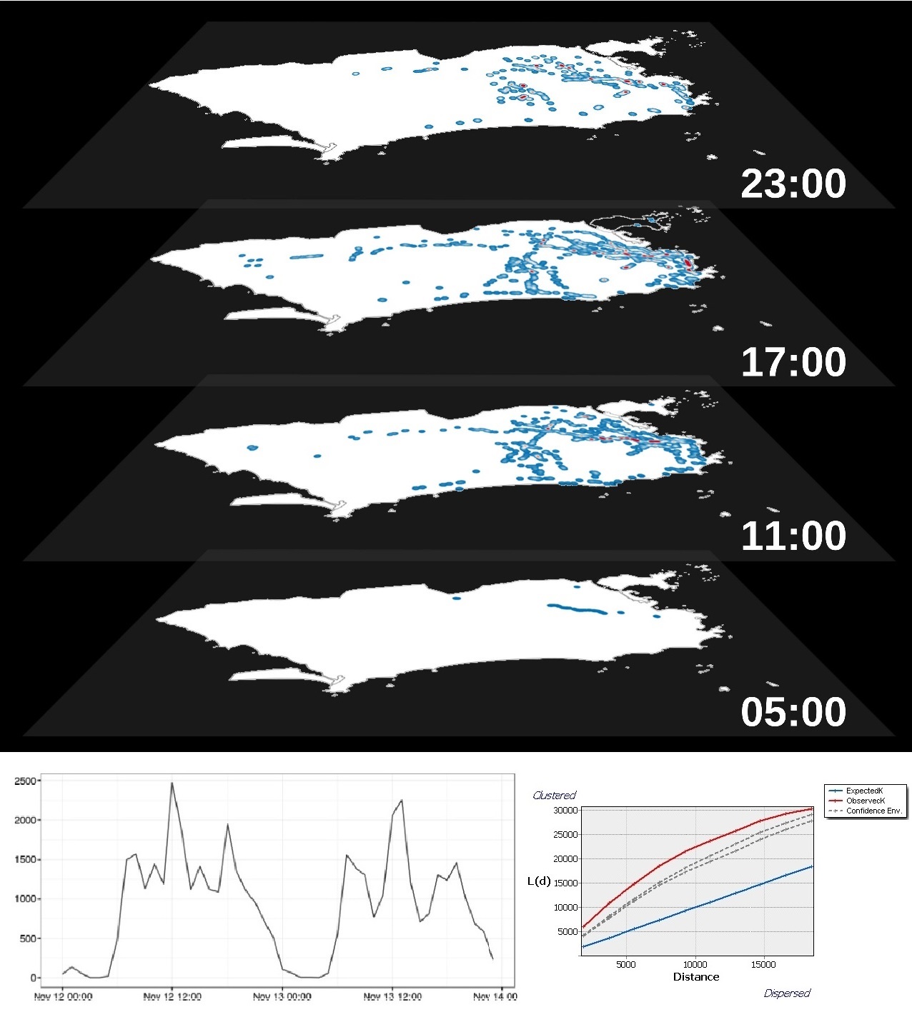
Potential encounters between social groups in Rio: the space-time prism (top panel) shows variation in encounter intensity between Twitter users across space and time. The bottom panels show the temporal distribution of encounters and their spatial clustering, measured through K-function analysis (Netto et al., 2018).
Together, these contributions establish a relational, process-based paradigm for understanding segregation as it is produced and reproduced in everyday urban life. Cities are approached as systems of movement, activity and interaction, where spatial configuration actively conditions social relations.
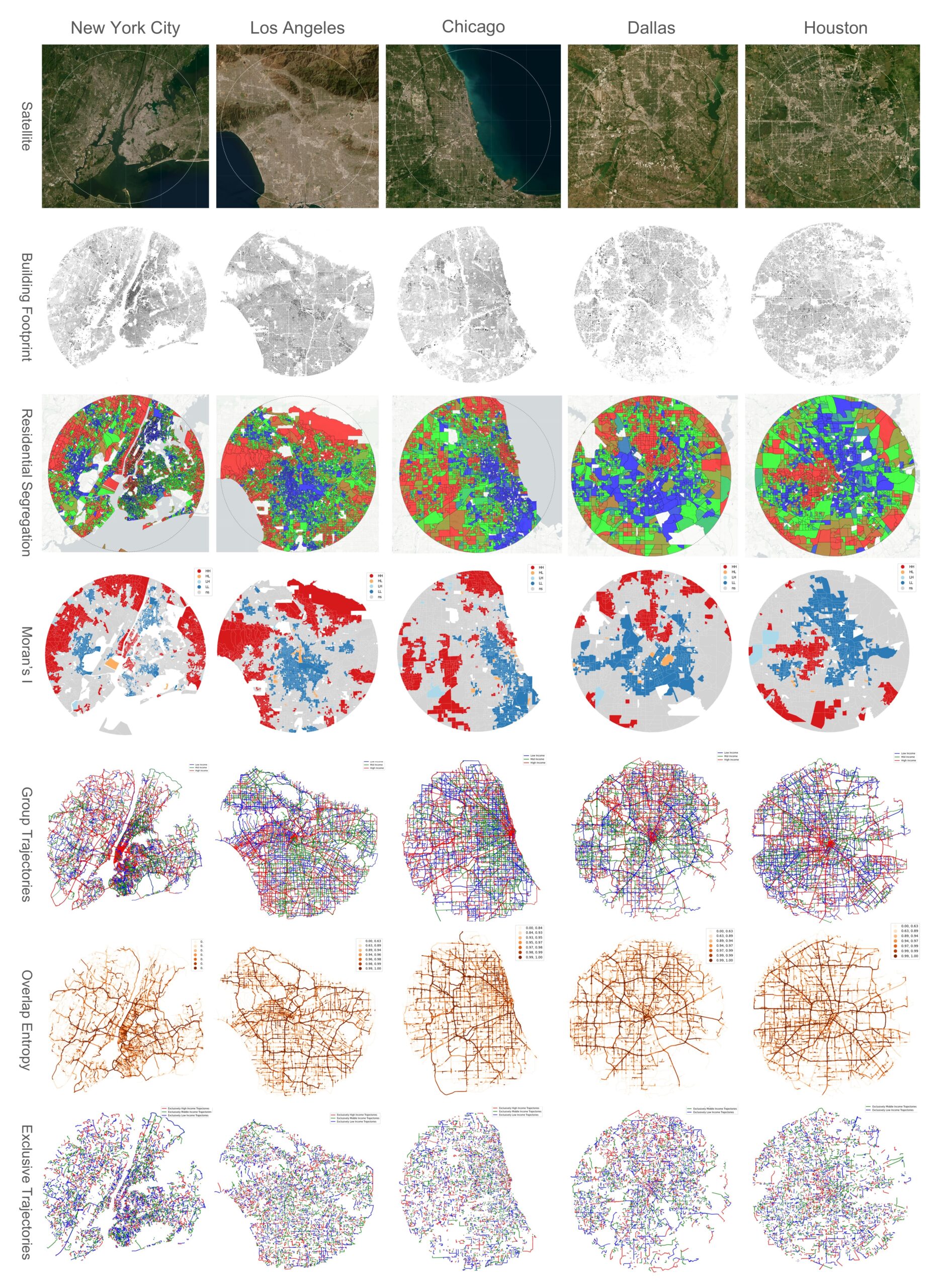
Mobility segregation in selected US cities: comparative analysis of five cases from a sample of 35 cities, showing (a) building footprints, (b) income distribution, (c) residential segregation based on Moran’s I clusters, (d) dominant income groups in movement networks, (e) social exposure, and (f) segregated or exclusive trajectories. Ongoing work with Ilgi Toprak.
The framework also opens possibilities for simulation and scenario analysis, allowing researchers to explore how changes in urban structure — such as new activity centres, transport systems or planning interventions — may reshape patterns of encounter, exposure and social integration over time (see SegX, our computer model of segregation and exposure experienced in daily movement and activities).
Publications
Netto, V.M.; Meirelles, J.; Pinheiro, M.; Lorea, H. (2018) A temporal geography of encounters. Cybergeo: European Journal of Geography. 844, https://doi.org/10.4000/cybergeo.28985
Netto, V.M.; Pinheiro, M.; Paschoalino, R. (2015) Segregated networks in the city. International Journal of Urban and Regional Research 39(6) 1084–1102 https://doi.org/10.1111/1468-2427.12346
Netto, V. M.; Krafta, R. (2001). Socio-spatial networks: social segregation as a real- time phenomenon. In Proceedings of the III international space syntax symposium, Atlanta 2001.
Netto, V. M.; Krafta, R. C. (1999). Segregação dinâmica urbana: modelagem e mensuração. Revista brasileira de estudos urbanos e regionais. Recife, PE. N. 1 (maio/nov. 1999), p. 133-152.