
Traditional segregation measures still present important limitations. First, they adopt a representation of space based on discrete homogeneous zones, often with a high level of aggregation and low resolution. Second, they oversimplify the possibility of interaction between zones, usually estimating it by their shape and the length of the common perimeter or by Euclidean distances between centroids. Finally, they underestimate the role of the street grid and how it can shape movement.
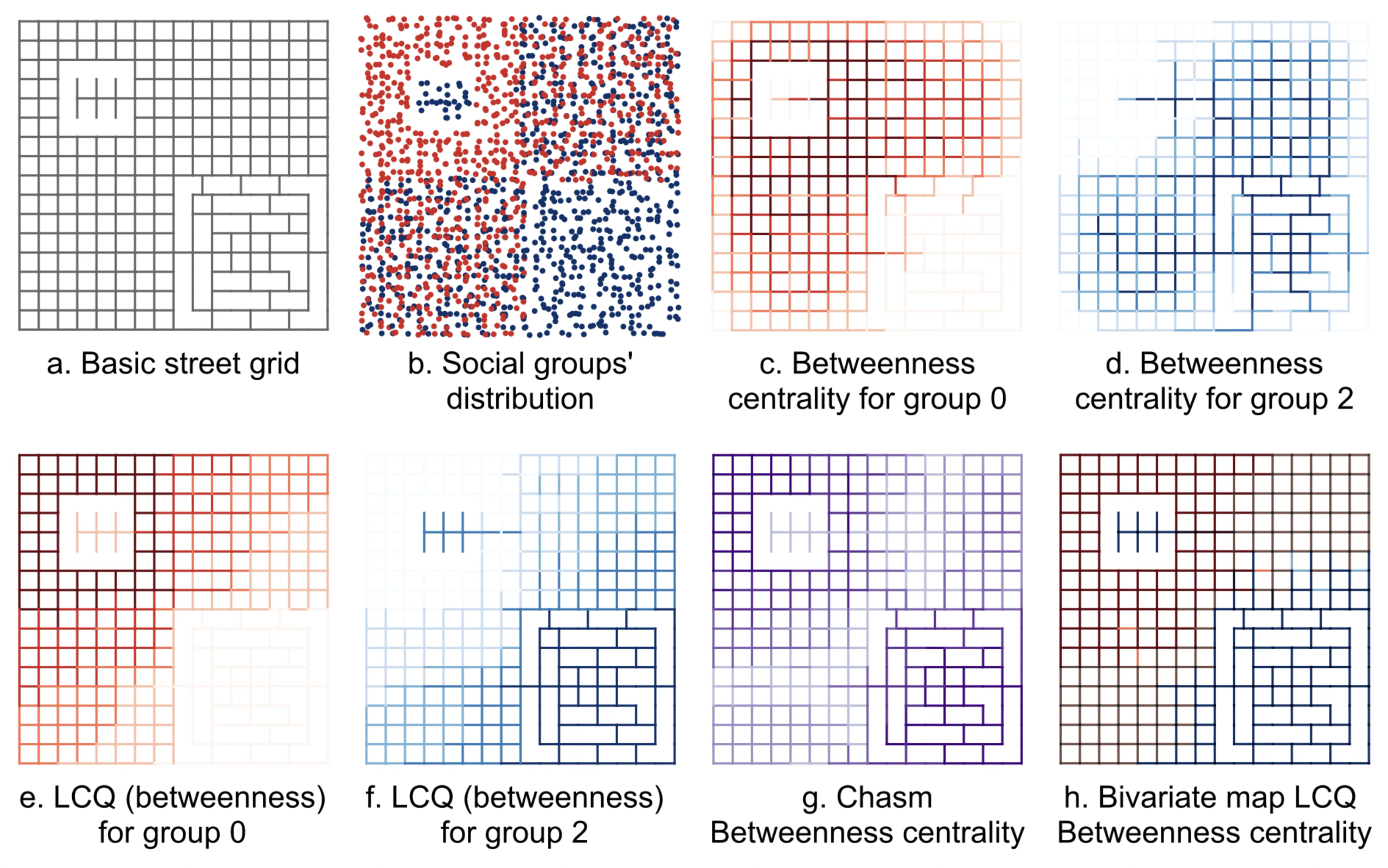
Operational steps and results for a betweenness configurational segregation measure for a simplified hypothetical scenario composed by: (a) a basic street grid (b) two social groups unevenly distributed. (Saboya & Peres, 2025)
We propose a new configurational measure of socio-spatial segregation that takes into account the possibilities of co-presence between individuals from different social groups afforded by the street layout configuration. Our model considers the potential of movement from places of residence both from the point of view of closeness and betweenness, comparing it with scenarios of non-segregation. This approach enables the characterization of the clustering of social groups in space and the assessment of their potential for shared destinations and trajectories. We argue that a socio-configurational model like the one proposed here:
– Provides greater resolution and avoids the coarse-grained definition of zones, allowing better estimation of distances and trajectories between different portions of the urban system.
– Enables analyses at different scales in a more organic way than those provided by combining distances between centroids with zones of arbitrarily defined sizes and shapes.
– Combines closeness and betweenness, two complementary ways of understanding movement in urban space.
– Opens new opportunities for analyses not afforded by zone-based analyses, such as evaluating alternative design proposals for new subdivisions or road interventions, checking how they could promote greater or lesser potential for co-presence between different groups.
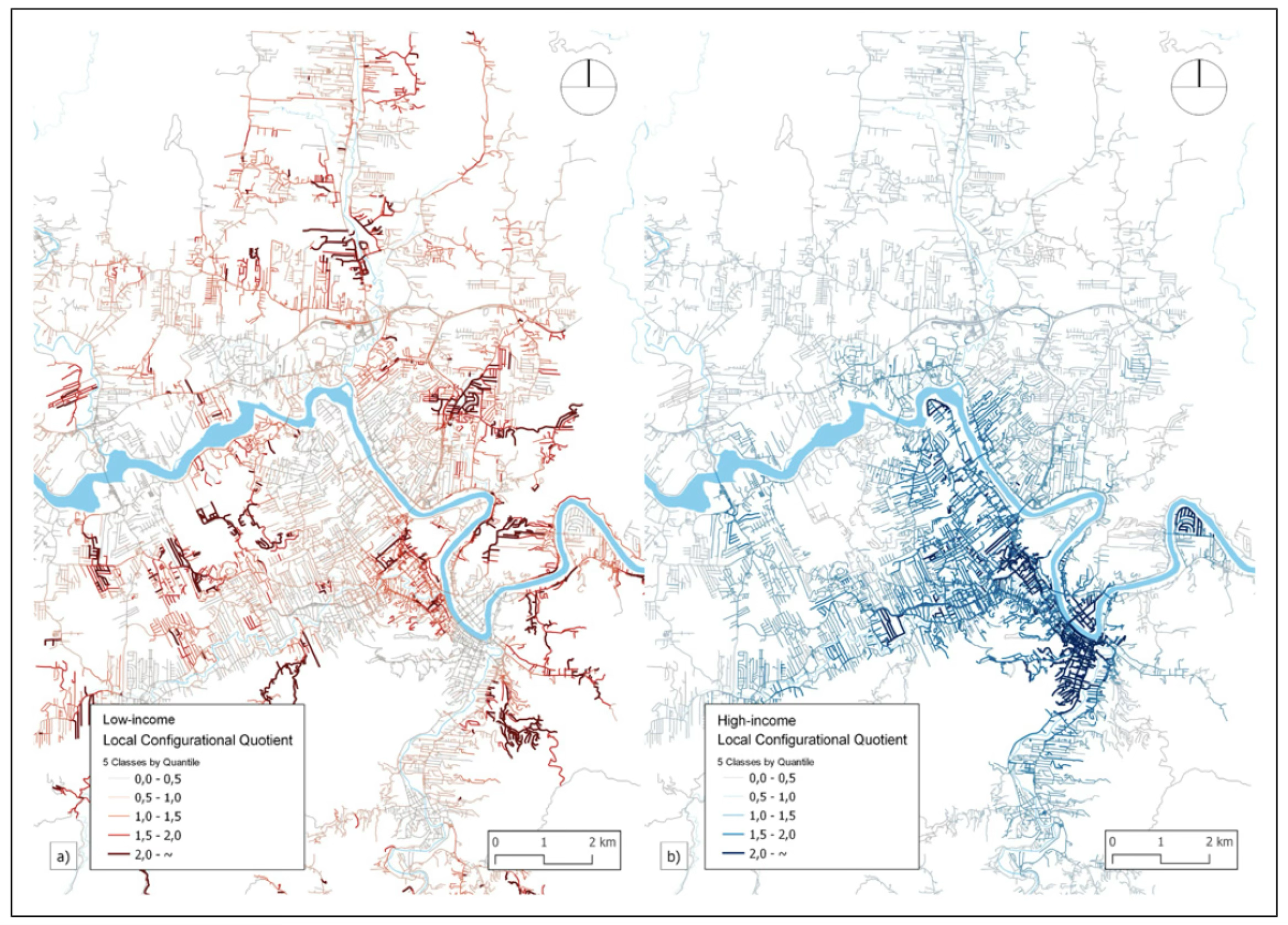
Local Configurational Quotient (LCQ) for Angular Betweenness Centrality (R1,000m) for a) low- and b) high-income groups. Higher values indicate over-representation of the social group’s centrality in the segment in relation to the control (non-segregation) scenario.
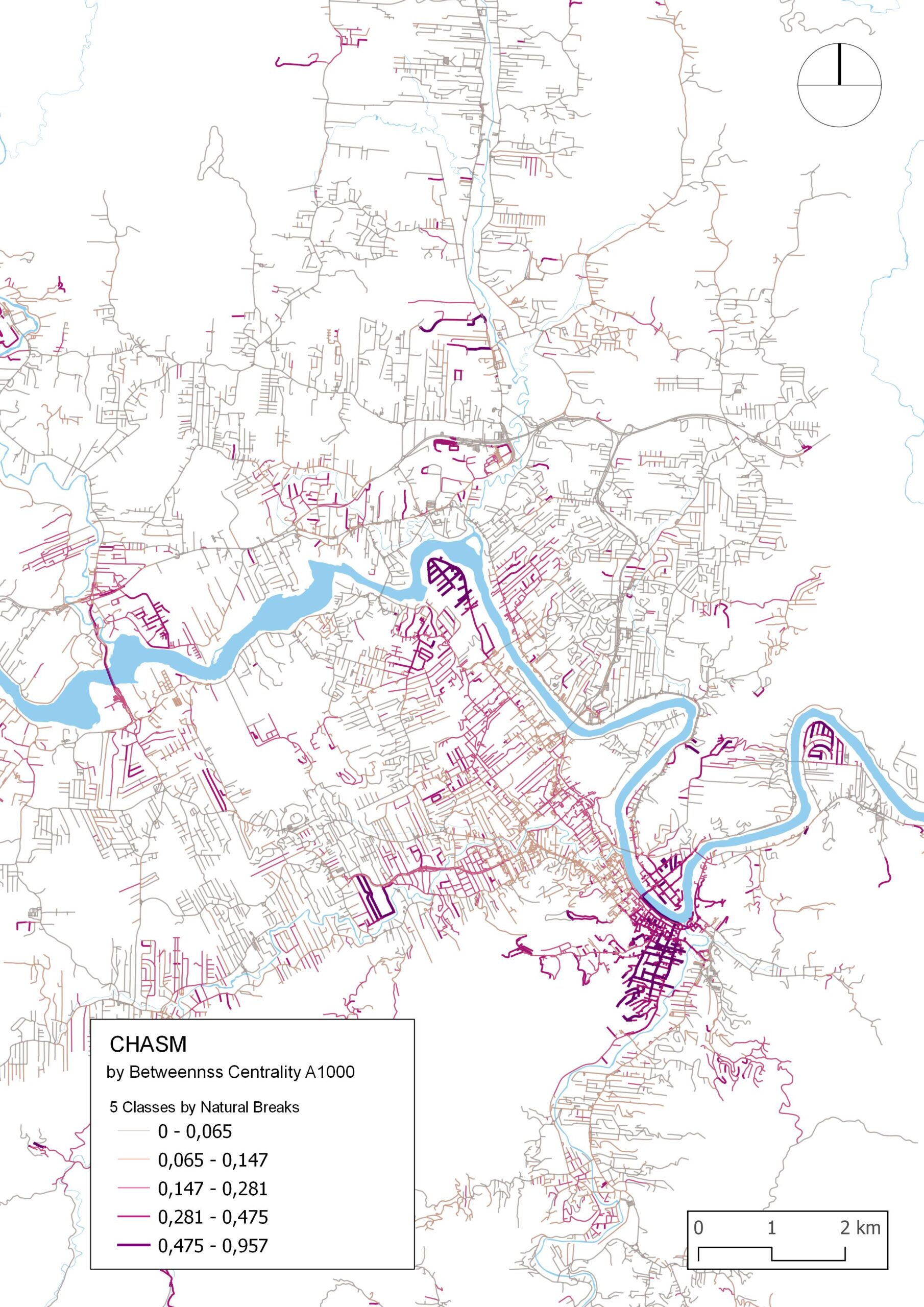
CHASM scores for Blumenau, SC, Brazil. Higher values represent areas where the estimated copresence afforded by the street grid is dominated by one income group; lower values indicate areas where the estimated copresence is more balanced between all three income groups.
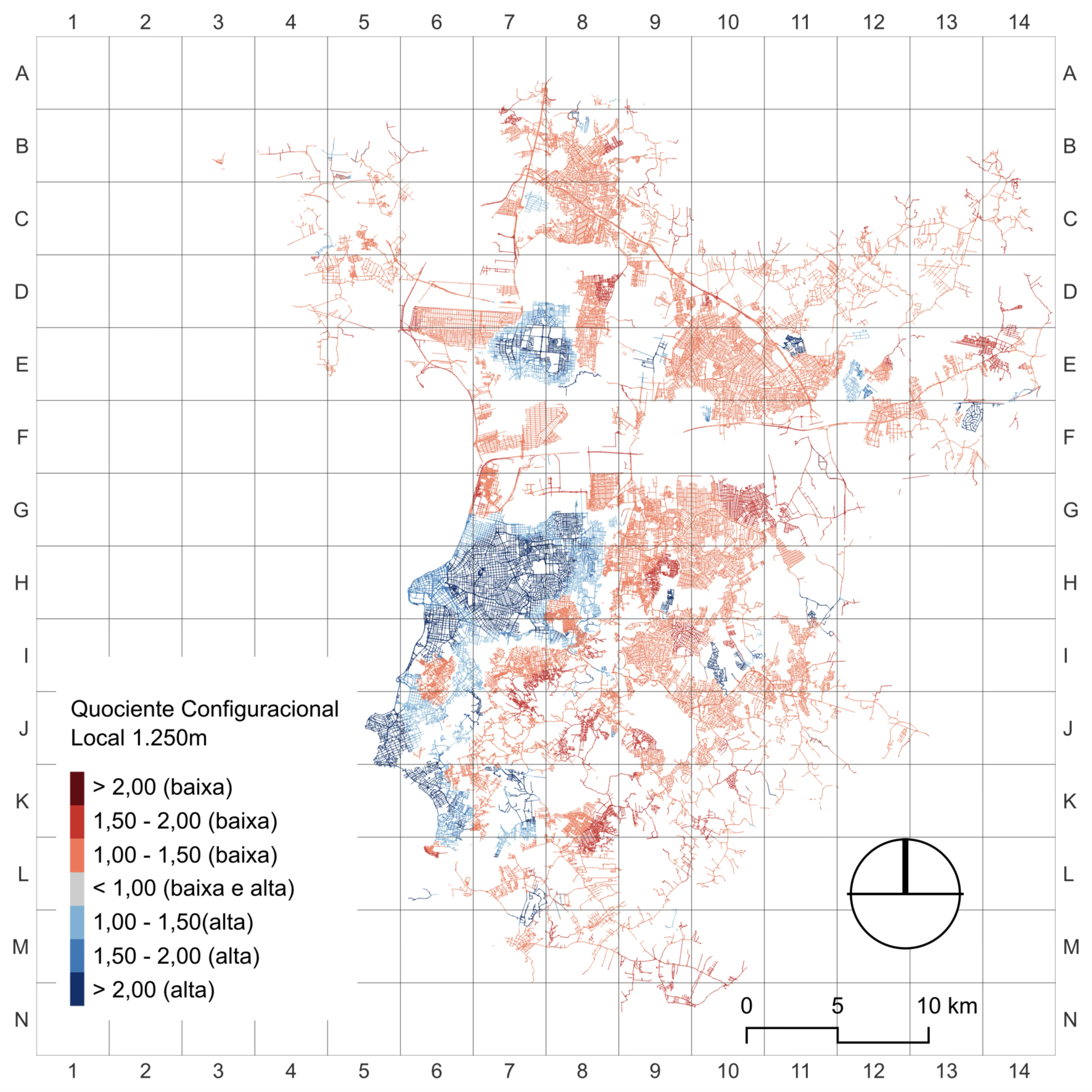
Local Configurational Quotient (LCQ) for Metric Reach (R1,250m) for low- (red) and high-income (blue) groups. Higher values indicate over-representation of the social group’s centrality in the segment in relation to the control (non-segregation) scenario.
Publication
Saboya, R. T. D., & Peres, O. M. (2025). CHASM: A configurational measure of socio-spatial residential segregation. Environment and Planning B: Urban Analytics and City Science, 52(6), 1464-1481. https://doi.org/10.1177/23998083241287701